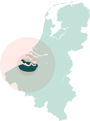
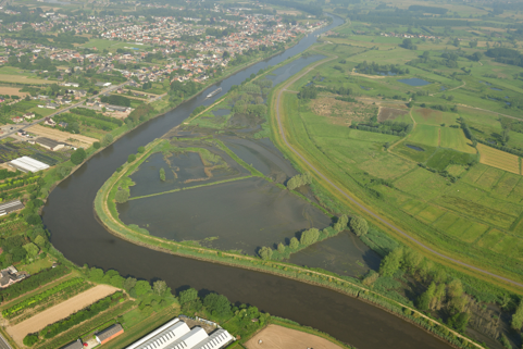
Scheldt Estuary

The Scheldt estuary has a full salinity gradient, from the tidal limit at Ghent in Belgium, towards the North Sea mouth at Flushing; it comprises the Sea Scheldt in Belgium, and the Westerschelde and Saeftinghe, a Ramsar and Natura 2000 site in the Netherlands .The Westerschelde has a multiple channel system, with ample mud/sandflats, providing habitats for benthic invertebrates, wintering birds and fish. Threats of the Scheldt are dredging and canalization for access to ports; pollution, and wind farm construction; and notably formerly land claim and canalization. Plans are now implemented to safeguard nature, whilst ensuring access to ports and safety against flooding. Managed realignment plans are being implemented

Challenges

  • Estuarine morphology: dredging and dumping (access to harbours)
  • Societal perception of managed re-alignment/depoldering (e.g. Hedwige)
  • Increased turbidity (Zeeschelde)
  • Reconciling flood protection (~ sea level rise) and nature values
  • Pollution

Main objectives

  1. 1
    Reconciling economic and ecological values (nature compensation)
  2. 2
    Flood protection (building with nature: depoldering, ‘flood polders’)
  3. 3
    Water quality

Key Opportunities

  • Various past and ongoing tidal flat and (salt/freshwater tidal) marsh restoration sites (various ages), and recent re-alignment (e.g., Hedwige)
  • Excellent long-term monitoring data of all key habitats 
  • Various national and international commissions (ZW Delta, Sigmaplan, Flemish-Dutch Scheldt committee (VNSC), Scheldemonitor, International Scheldt Commission (ISC), Long-Term Vision on the Scheldt estuary (LTV), etc. plus engaged authorities, such as Rijkswaterstaat

Current and future restoration actions

Contact Person

Main contact
Daphne Van der Wal
Main contact
Koen Sabbe