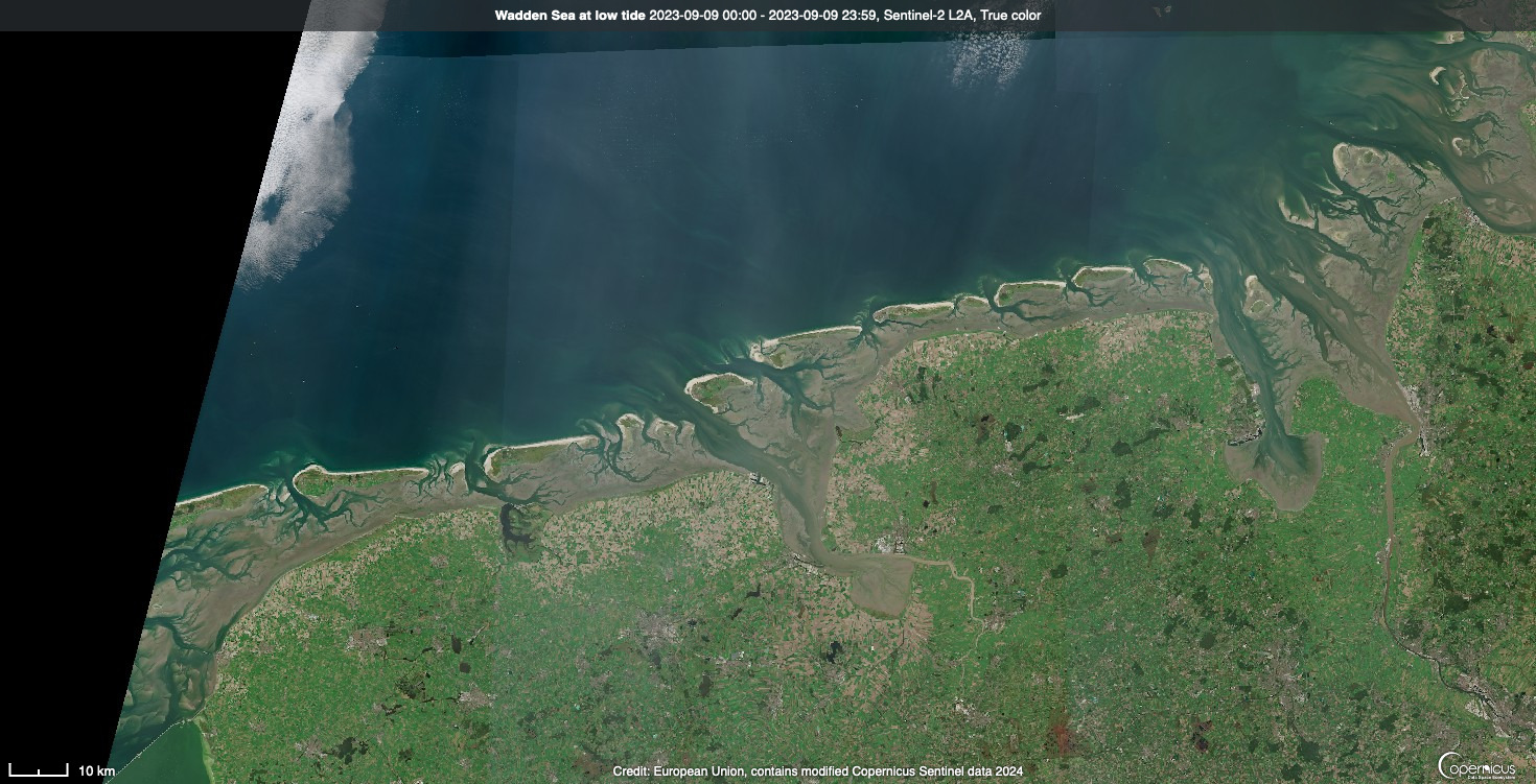
Our Mission

Our mission is to revilatise Europe's intertidal areas through rewilding, a nature-driven approach, promoting climate resilience, biodiversity, and societal benefits for the European shoreline.
Our initiative fosters interdisciplinary collaboration to advance rewilding, engage stakeholders, scale up strategies, and create effective tools for a resilient and safe European coast.

Remote Sensing and Stakeholder Engagement:

The Perfect Combination 

We engage people from the very beginning. 
Through our workshops and remote sensing visualisations, they will be able to see our seascapes in the past, present and future. 

Each remote sensing visuslisation corresponds to determined validation methods and projections.  

  1. mm2

    • Field campaigns, 
    • Lab experiments, 
    • User Interviews

  2.   

    cm2

    • Field campaigns, 
    • Lab experiments, 
    • User Interviews
    • 3D visualisation

  3.  

    m2

    • Field campaigns, 
    • Lab experiments, 
    • User Interviews
    • 3D visualisation
    • numerical modelling

  4. km2

    • 3D visualisation
    • numerical modelling

  5. 100 km2

    • 3D visualisation
    • numerical modelling

  6. Global

    • numerical modelling

Rewrite Key Concepts

Co-design & scenario analysis

Making people part of the rewilding process

The Multi-Actor Labs will play a crucial role in the REWRITE project by providing a platform for stakeholders to share their knowledge and expertise, co-design rewilding scenarios, and engage with the research process.

Back-casting Scenario

REWRITE will work backwords to fulfil what is missing from a desired new state

Cognitive-based Scenario

simulated based on systems thinking and the perception of local communities.

Global Level

Global Multi-Actor Laboratories will ensure the engagement of stakeholders at European and regional level.

Local Level

Local Multi-Actor Laboratories at the demonstartion sites will ensure the engagement of stakeholders at the local level.

Innovative Tools

Collecting the right data

REWRITE will use innovative tools to collect detailed data on ISS seascapes that will allow REWRITE to develop rewilding scenarios that optimise ecosystem services and promote climate resilience
To assess ecosystem services we develop an innovative approach coupling robust tools of observation, based on our network of demonstrators along a latitudinal and longitudinal gradient (i.e the “Space-for-time substitution)
  • Remote sensing

    Remote-sensing to quantify and map C storage and sequestration, biodiversity, and ecological integrity from the local to the global scale
  • Eddy-covariance method

    High frequency measurement of CO2 fluxes to estimate if intertidal areas are source or sink of C

  • Ecosystem Assessment

    Rapid Ecosystems Assessment (REA) for biodiversity survey (e.g. GoPros, squid-pops and algae-pops)
  • eDNA

    To investigate biodiversity from the microorganisms to the vertebrates

To co-design scenario of rewilding and project the future by 2050

  • Coupling modelling remote-sensing and numerical modelling

    Simulating ecosystem services change accordingly to IPCC climate scenarios to demonstrate the efficiency of rewilding scenario to mitigate global warming and sea level rise

  • 3D Visualisation

    To generate long-term, historic coastal change picture and project the future regarding sea level rise and the shape of the tidal area alters to generate asset-specific visualizations for scientists and stakeholders

  • Narrative of changes

    Analyzing and comparing the stakeholders’ discourses addressing uses, meanings, values, perceptions and representations of heritage and nature to point out the pathways and possibilities for rewilding options and the needed trade-offs and negotiations at the local scale

A set of tools designed to determine appropriate ecosystem services provision and tools for maximising the potential for beneficial social engagement in different governance landscapes
  • Valuation approaches

    Estimate the costs and benefits for nature and society by plural and integrated valuation approaches.
  • Protocols to survey and monitor rewilded area

    Development and deployment of evidence-informed tools and protocols based on our observation and projection tools to estimate and improve the outcomes of rewilding efforts